
Land Demarcation: Meaning, Process & Importance
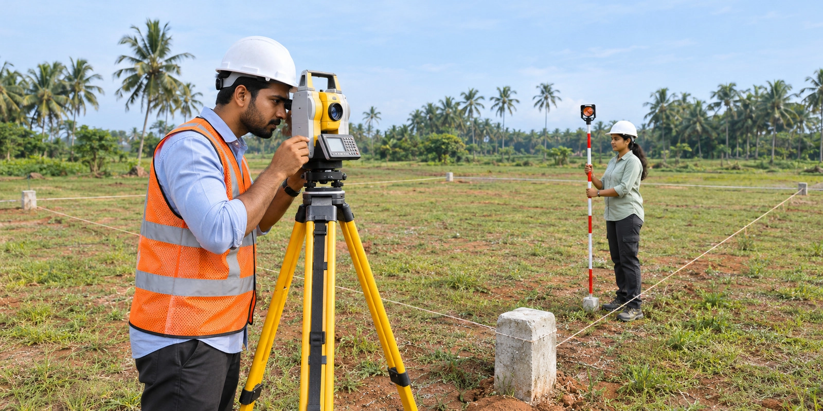
Land demarcation identifies the exact boundaries of a plot using official survey records. Learn why it matters before buying land, which documents are required, how the process works and what to do in a boundary dispute.
Ask ten people what they check before buying a plot and most will say the same three things: the location, the price and the papers. Hardly anyone asks where the land actually starts and stops. It may seem like a minor detail, but the boundaries shown in property documents do not always match what you see on the ground. Boundary stones may be missing, buried or moved. Old markings can wear off, and when a large parcel is divided among heirs, the updated measurements may not always be reflected in the records.
Now and then two documents for the same plot even quote different sizes. People usually find out when the mason is about to build the compound wall, or when a buyer turns up to look at the plot for resale. That is the point where land demarcation helps. A surveyor takes the survey records and the measurements, and then fixes the limits of your plot on the ground.
You also see how your plot sits next to the neighbouring plots, the road and any footpath nearby. Here is a simple example. Say you build a wall along one edge, and your measurement is out by a few feet. The wall may end up on your neighbour’s land or on a public path, and you could be asked to knock it down. Or say two owners argue about the line they share.
An official measurement shows what the records say, so nobody has to guess. There is one thing to keep in mind. Finding a boundary does not prove who owns the land. The measurements have to be read along with the title deed, the revenue records and the approved layout. The usual way is to note the survey number, collect your records and approach the survey office. The exact steps can differ by place, by type of land and by whether a dispute is already running. So before you pay for any plot, check the papers and the ground together. In this guide, you will find the meaning, the documents, the steps and what to do if a boundary dispute begins.
Table of Contents
- What Is Land Demarcation?
- Why Is Land Demarcation Important Before Buying a Plot?
- What Documents Are Required for Land Demarcation?
- How Is Land Demarcation Carried Out?
- How Can You Verify Property Boundaries on the Ground?
- What Should You Do If a Land Boundary Dispute Arises?
- What Is the Difference Between Land Demarcation and Land Surveying?
- Conclusion
- Frequently Asked Questions (FAQs)
What Is Land Demarcation?
The land demarcation meaning is easy to follow. It is the work of finding and marking the edges of one piece of land, using survey records, measurements and fixed reference points.
Put simply, it tells you where your land starts and stops. The surveyor checks the survey number, the subdivision details and any boundary stones on site.
It helps when you want to:
- Find the limits of a plot before you build
- Check if a compound wall sits on the recorded line
- Settle a shared boundary with a neighbour
- Compare the real measurements with your papers
- Spot encroachments or a gap in the recorded size
Keep one limit in mind. Land demarcation shows the recorded boundaries only. It does not decide who owns the land.
Why Is Land Demarcation Important Before Buying a Plot?
Checking the boundaries before you pay can save you months of stress. Here is why it matters.
- The papers may say 2,400 square feet, but only a measurement tells you if you will get that much on the ground.
- A neighbour’s wall, fence or shed may already sit a little inside your plot.
- Once you know the limits, you can place the wall and house without stepping onto someone else’s land.
- Matching the survey details with the sale deed, Patta and layout can show mismatches early.
A property boundary survey helps most when the markings are unclear or two records show different measurements. Before you hand over an advance, compare the survey number, subdivision and dimensions with the records. If something does not match, ask for land demarcation and get a clear answer from the office or a professional first.
What Documents Are Required for Land Demarcation?
Before you ask for a measurement, gather the papers that identify the property and its recorded size. The list can vary a little between offices, but these are the usual ones.
- Registered sale deed, showing the survey number, size and boundaries
- Patta, which contains the recorded landholder's details in the revenue records
- Chitta or revenue extract, a copy of the village record
- FMB sketch, a map of the field with the length of each side
- Encumbrance Certificate, which shows registered transactions and encumbrances recorded against the property
- Approved layout plan, if your plot is in a layout
- Identity and address proof, such as Aadhaar, voter ID or driving licence
Fill in your application for land demarcation with the exact survey and plot details, so the office does not pull out the wrong file.
Take the originals along with a set of photocopies. Without the subdivision details, the office may delay your request or the surveyor may measure a different parcel.
Also Read: DTCP Approved Plots: Meaning, Benefits, Approval Process & How to Check
How Is Land Demarcation Carried Out?
In general, the office reviews the records, identifies the parcel, measures its limits and marks them on the ground. Some steps differ between places, but the land demarcation process usually runs like this.
- Collect the sale deed, Patta, FMB sketch and any other records.
- Note the district, taluk, village, survey number and subdivision number.
- Apply at the revenue or survey office the way they ask.
- Submit the records they ask for and pay the fee.
- Wait for the date of the surveyor’s visit.
- The surveyor measures the site and matches the figures with the official records.
- Depending on the site, boundary points may be marked on the ground.
- Collect the survey report or sketch and keep it safe.
A land measurement survey checks the size on record against the land that is actually there. Quote the same survey number and subdivision every time you deal with the office.
Whether you can use land demarcation online services depends on the state portal and the service in question. In Tamil Nadu, you can view available land records on the e-Services portal at https://eservices.tn.gov.in/eservicesnew/. Viewing a record online is not the same as an official field measurement, so confirm the current steps with the Taluk office or the Survey and Land Records authority.
How Can You Verify Property Boundaries on the Ground?
Once your papers are ready, walk the site with them in hand. This works best when the land is vacant, or the boundary stones are hard to find.
- Make sure the survey and subdivision numbers on your papers match the plot you are standing on.
- Open the FMB sketch and look at the shape of the field and the length of each side.
- Look for boundary stones, but don’t rely on them alone. Someone may have moved them.
- Measure the length and width yourself and compare the figures with your records.
- See where the neighbours’ fences and walls and the nearby road run. They give you a rough idea of the line.
- If the numbers still don’t add up, call a licensed surveyor or the survey office.
If the figures still do not match, a property boundary survey conducted by the concerned survey authority can verify the measurements against official records. You can also consult a qualified surveyor for professional assistance. Do not shift boundary stones, pull out markers or build a wall on guesswork. Get the measurements verified through land demarcation first.
What Should You Do If a Land Boundary Dispute Arises?
Disputes usually start when neighbours have different measurements, boundary stones are missing, or two documents contradict each other. A request for land demarcation early on can settle the recorded limits before the problem reaches your construction or your resale.
- Put the sale deed, Patta and FMB sketch side by side and see where the figures differ.
- Speak to your neighbour and try to settle it calmly.
- Ask the survey office for an official measurement of the boundary.
- Keep copies of the deed, old survey records and photos of the site.
- Meet a property lawyer if the matter drags on or someone claims the land.
When you apply, attach copies of the deed, the FMB sketch and any earlier survey records to your application for land demarcation. A land boundary survey can establish the recorded position of the limits. If the dispute involves rival ownership claims or a tangled title, a measurement alone may not settle it.
Also check whether land demarcation online services are available in your area. Online records help you review the details, but you may still need an official field inspection.
What Is the Difference Between Land Demarcation and Land Surveying?
The two terms are related but not the same. Surveying measures land, while demarcation identifies and marks its boundaries.
| Basis | Demarcation | Surveying |
|---|---|---|
| Main purpose | Identifies and marks property boundaries | Measures and records land features and dimensions |
| Focus | Property limits and boundary points | Area, shape, levels and features |
| Records used | Survey records, FMB sketches and property documents | Survey maps, measurements and technical data |
A land measurement survey may be done as part of the work needed to identify boundaries, and it gives figures you can compare with the records. Knowing the land demarcation meaning also helps buyers tell a general measurement exercise from an official boundary identification.
The wider land survey process can include measuring, drawing sketches and recording physical features. Boundary identification then uses those measurements and records to fix the limits of one parcel.
If you are looking at plots in ECR gated community projects, check the approved layout, plot dimensions, survey details and physical boundaries before you pay anything.
Conclusion
Knowing the exact boundaries of a plot is part of buying, owning or developing land. It shows the real extent, helps you catch encroachments and keeps you out of arguments with neighbours. Compare the sale deed, revenue records, FMB sketch and approved layout. If the boundaries look unclear, ask the survey authority instead of trusting what you see on site.
Anyone looking at plots in manali should also check the measurements with official records. Once land demarcation is done, you know where the recorded edges of your plot run and where your papers and the ground disagree. It will not tell you who owns the plot, though. Get the title checked as well, and do both before you pay the final amount.
Also Read: Land Encroachment: Laws, Rules and What Property Owners Should Know
Frequently Asked Questions (FAQs)
Recent Blogs




Blog Categories
Plots by Locations
- Plots for Sale in Chennai
- Plots for Sale in Thirumazhisai
- Plots for Sale in Madhavaram
- Plots for Sale in Manali New Town
- Plots for Sale in Mudichur
- Plots for Sale in Naduveerapattu
- Plots for Sale in Poonamallee
- Plots for Sale in ECR
- Plots for Sale in Kundrathur
- Plots for Sale in Mangadu
- Plots for Sale in Manimangalam
- Plots for Sale in Maraimalai Nagar
- Plots for Sale in Minjur
- Plots for Sale in Moolakadai
- Plots for Sale in Pallavaram
- Plots for Sale in Perambur
- Plots for Sale in Redhills
- Plots for Sale in Tambaram
- Plots for Sale in Ponneri
- Plots for Sale in Thandalam
- Plots for Sale in Perungalathur
- Plots for Sale in Vandalur
- Plots for Sale in Tiruvottiyur
- Plots for Sale in Tondiarpet
- Plots for Sale in Villivakkam